
The Appalachian Trail (AT) is one of the most iconic hiking trails in the world, winding along the Appalachian Mountains for over 3,500 km, crossing 14 U.S. states from Georgia to Maine. This adventure attracts thousands of hikers each year, some of whom take on the challenge of completing the entire route, known as the “thru-hike.”
A Journey Through Nature and History
Created in the 1930s from the vision of Benton MacKaye, the trail has become a symbol of challenge, endurance, and connection with nature. Hiking it means immersing oneself in breathtaking landscapes, traversing dense forests, scaling panoramic peaks, and discovering villages rich in history and tradition.
Technical Data and Trail Features
- Length: Approximately 3,500 km (2,190 miles)
- Average thru-hike duration: 5-7 months
- States crossed: Georgia, North Carolina, Tennessee, Virginia, West Virginia, Maryland, Pennsylvania, New Jersey, New York, Connecticut, Massachusetts, Vermont, New Hampshire, Maine
- Highest point: Clingmans Dome (2,025 m), Tennessee
- Lowest point: Bear Mountain Zoo (38 m), New York
The Appalachian Trail is well-marked with the classic “white blazes” on trees and rocks and is divided into sections with varying difficulty levels.

Ph: Sean Foster -Unsplash
What to Expect Along the Trail
The Appalachian Trail is as fascinating as it is challenging. The climate varies greatly depending on the season and region, ranging from hot and humid summers to harsh winters with snow. Wildlife includes black bears, deer, snakes, and a wide variety of birds.
The scenery is among the most stunning in the U.S., from the Great Smoky Mountains to the White Mountains and the untouched forests of Maine. Some must-see highlights include:
- McAfee Knob (Virginia) – One of the most photographed viewpoints on the trail.
- Shenandoah National Park (Virginia) – A relatively easy section with many amenities.
- White Mountains (New Hampshire) – One of the most difficult and spectacular sections.
- 100-Mile Wilderness (Maine) – The final remote and rugged stretch.
National Parks Along the Trail
The Appalachian Trail passes through numerous national parks and protected areas, offering hikers an exceptional variety of landscapes and biodiversity. Some of the major parks along the route include:
- Great Smoky Mountains National Park (Tennessee/North Carolina) – One of the most visited national parks in the U.S., known for its ancient forests and rich wildlife.
- Shenandoah National Park (Virginia) – Featuring the Skyline Drive, which runs parallel to the trail, offering spectacular views and well-maintained trails.
- Delaware Water Gap National Recreation Area (Pennsylvania/New Jersey) – A scenic river region with waterfalls, gorges, and lush forests.
- Green Mountain National Forest (Vermont) – Stunning views of the Green Mountains with varied terrain between forests and mountain ridges.
- White Mountain National Forest (New Hampshire) – A challenging area with some of the most spectacular peaks on the trail.
- Baxter State Park (Maine) – Home to Mount Katahdin, the northernmost point of the trail, known for its wild and remote beauty.
Hiking through these parks is not only an immersive nature experience but also requires adherence to local regulations that protect these precious environments.

Ph: Dawn Gaddis – Unsplash
Preparation and Equipment
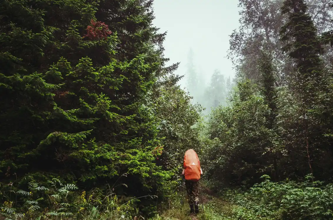
Tackling the Appalachian Trail requires careful planning and physical preparation. It’s essential to gradually get used to long hikes with a loaded backpack, improve endurance, and strengthen leg and back muscles. Progressive hikes combined with cardio and strength training can make a big difference.
Essential Equipment
Having the right gear can determine the success or failure of the adventure. Balancing weight and functionality is crucial:
- Backpack (50-65 L): Ergonomic and well-balanced.
- Tent or hammock with tarp: Essential for weather protection.
- Sleeping bag: With a temperature rating suitable for seasonal conditions.
- Insulated sleeping pad: Enhances comfort and thermal insulation.
- Hiking shoes: Lightweight, durable, and supportive.
- Technical clothing: Breathable, windproof, and waterproof layers.
- Water purification system: Portable filters or purification tablets for treating water from streams.
- Camping stove and lightweight cookware: For cooking hot meals at base camps.
- Lightweight, nutritious food: Freeze-dried meals, energy bars, nuts, and dried fruit.
- First aid kit: Includes bandages, disinfectants, pain relievers, and essential medications.
- Map, GPS, and compass: For navigation if needed.
- Trekking poles: Reduce knee strain and improve balance.
Hiking Directions, and Season
- Southbound (SOBO): Starts in Maine and ends in Georgia. Ideal for those preferring a tougher start with progressively easier terrain. Typically starts between June and July.
- Northbound (NOBO): The most popular route, starting in Georgia and ending in Maine. Hikers usually begin between March and April to avoid northern winter conditions.
- Flip-Flop: A flexible alternative starting at a mid-point (often Harpers Ferry, West Virginia) and heading in both directions to avoid crowds and extreme weather.
Best Seasons to Hike
- Spring: Best for NOBO thru-hikers, avoiding extreme temperatures and snow.
- Summer: Ideal for SOBO hikers, starting in Maine after the snow has melted.
- Autumn: Perfect for section hikes, with mild temperatures and spectacular fall foliage.
- Winter: Not recommended for a thru-hike but feasible for short, well-equipped hikes.
Key Trail Sections and Access Points
- White Mountains (New Hampshire): One of the most technical and challenging sections.
- 100-Mile Wilderness (Maine): No resupply points for about 160 km.
- Southern Appalachians (Georgia, North Carolina): A tough initial challenge for NOBO hikers.
Ph: Daniil Silantev – Unsplash
How to Reach the Starting Points
Northern Start: Mount Katahdin, Maine
- Nearest airports: Bangor International Airport (BGR) or Portland International Jetport (PWM).
- Public transportation: From Bangor Airport, take a bus to Millinocket, then a shuttle to Baxter State Park.
- Private car: Baxter State Park is accessible by car, but roads are unpaved and seasonally restricted.
Southern Start: Springer Mountain, Georgia
- Nearest airport: Hartsfield-Jackson Atlanta International Airport (ATL).
- Public transportation: Take a MARTA train to North Springs, then a shuttle to Amicalola Falls State Park.
- Private car: Parking available at Amicalola Falls State Park, with a 13 km approach trail to Springer Mountain.
Conclusion
Hiking the Appalachian Trail is a transformative experience, a journey that requires preparation, endurance, and passion. Whether embarking on a thru-hike or exploring a short section, every step on this trail leaves an indelible mark on the heart of those who walk it. Are you ready for the adventure?
Autor & Comments:
About the Author: admin
A quick overview of the topics covered in this article.